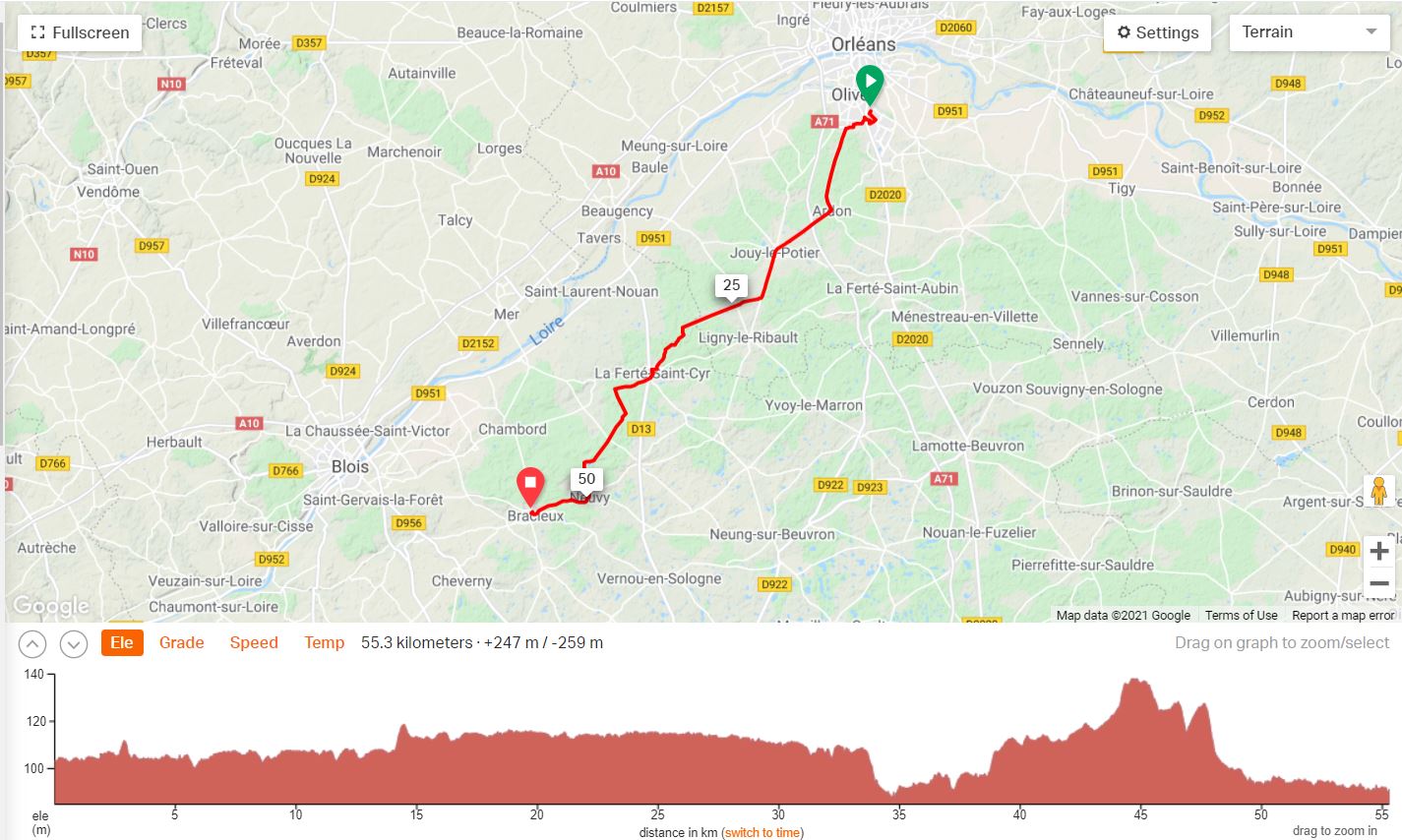
| 55.3 Kms & 247 Mts |
 |
| Neil & Wendy Cycle Scotland & France 2018 | ||||||||||
| Previous Page | Menu | Next Page | ||||||||
| Orleans to Bracieux, France | ||||||||||
| 7th July 2018 | ||||||||||
Writing up our journey four years later and some days I can remember every last inch of the road, other days I can remember nothing. This is one of them, I remember riding past the church opposite the camping area at Bracieux and that is it. Looking through the photos generally helps but all I have is four photos of a village with nothing to identify the town. Looking at the route map and nothing comes to mind. Looking more closely at the photos, one has a signpost and some distances, zooming in and it says :-
Romorantino was too far so I looked up Neung on google maps and then asked for directions to Ligny and Orleans. Distances align pretty closely to the kink to the right on the map at the '25' on the map, which would have been about time for morning tea. Dragging the little googlemap man onto the D15 and travelling back towards Bracieux I came to the little village of Jouey-le-Potier with a church door with a pedestrian door, turning through 180 degrees and there was my street sign. Wendy had two photos one of her and a forest and a sign and a closeup of the sign which read "Zone de Silence" ? What sort of forest does not allow any noise. However on thinking about a forest I recall one day when we got disoriented riding through a forest on fire trails and kept hitting private property signs. We eventually got out of the forest and I now believe this was that day. Most of it was spent in wooded countryside which doesn't make for interesting photos.
|
||||||||||